GPS LOG
Tracking the movement of wood is not a new idea, scientists have been doing it for decades. This science-communication project tracks the movement of wood down the McKenzie River live.
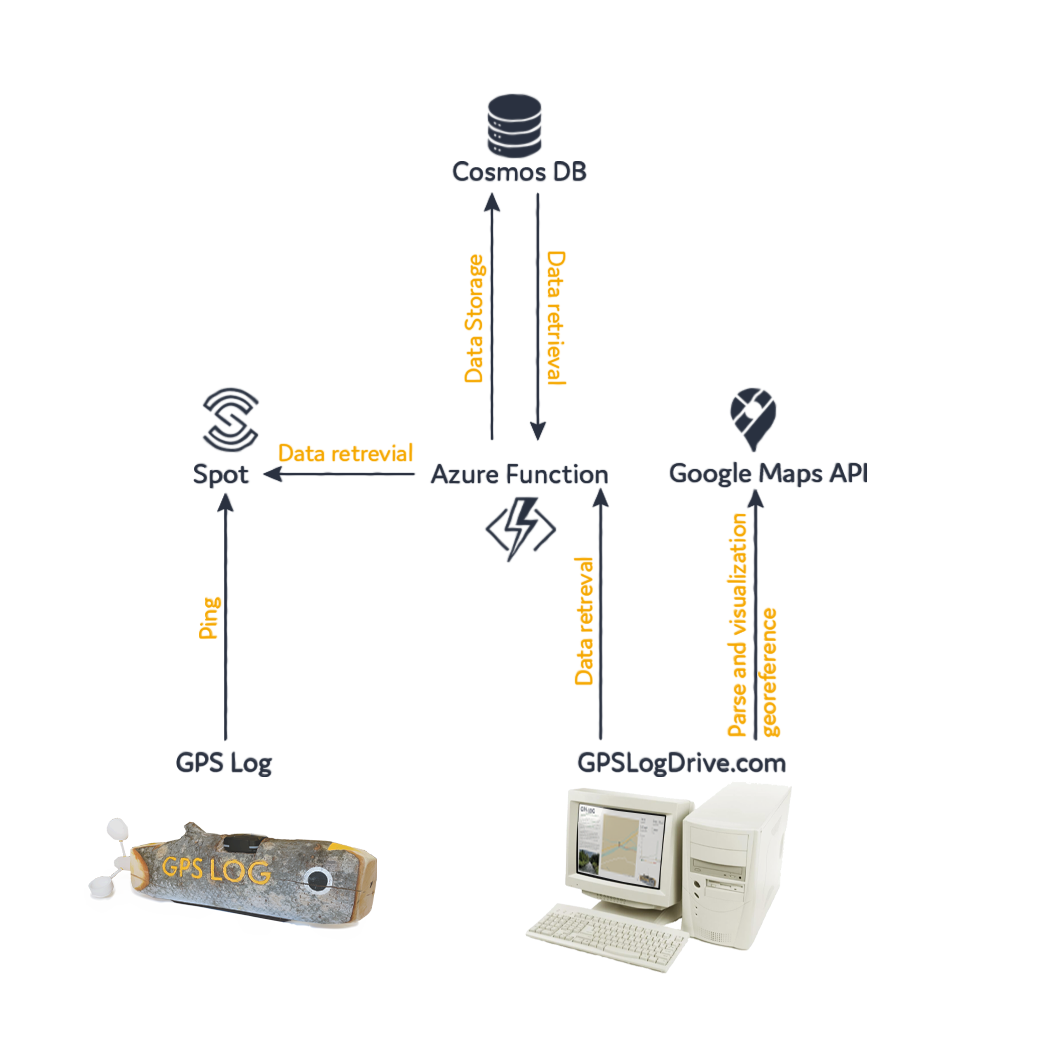
Fig. 1: GPS Log’s connection to the world wide web
GPS Log connects people to the movement of wood via the world wide web. This GPS Technology allows users to track the location of GPS Log live and moving at wood’s pace.
Software Engineer, Kadence Neuens, collaborated with GPS Log to create website that interprets the movement of wood from the forest to the seas, displays the path, and shows statistics too!
GPS Log will collect data for the rest of the summer for William Bonner to then transform into data visualization art for further interpretation.
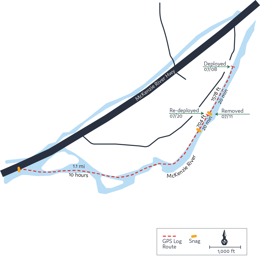
GPS Log was deployed July 8th at the Greenwood Landing in Leaburg, Oregon.
To date, GPS Log has been snagged 3 times and traveled 1.5 miles down the McKenzie River.
Fig. 2: GPS Log’s path from July 8th to Oct 25th

Engineering and Deployment
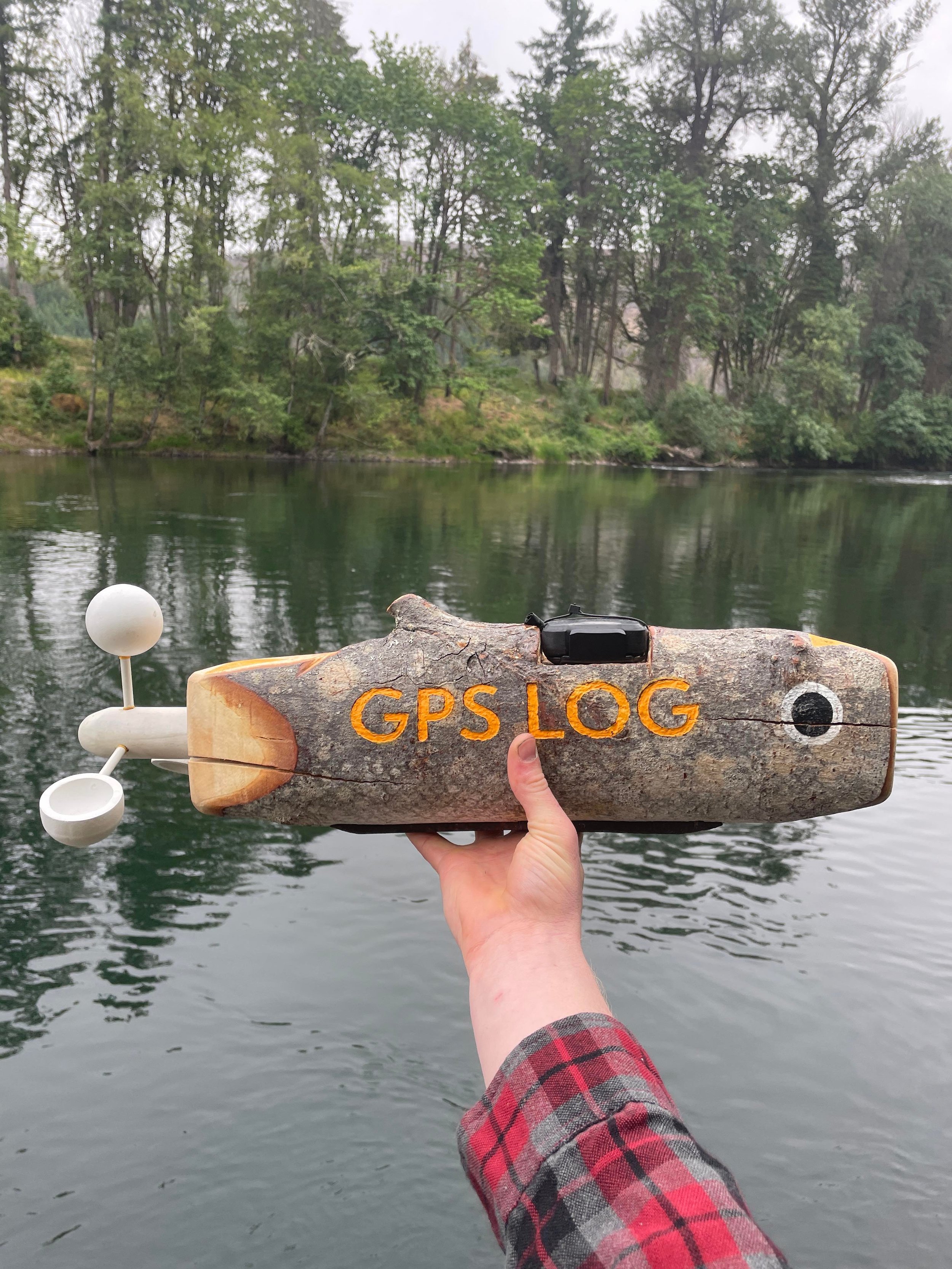
GPS Log’s body was carefully selected from the University of Oregon’s Facilities burhs pile for its’ characteristic fishiness. This shape was ideal for GPS Log’s aesthetic, but compromised the effectiveness of the tec which needs to be above the water, pointing towards the sky.

Fig. 3: GPS Log’s anatomy
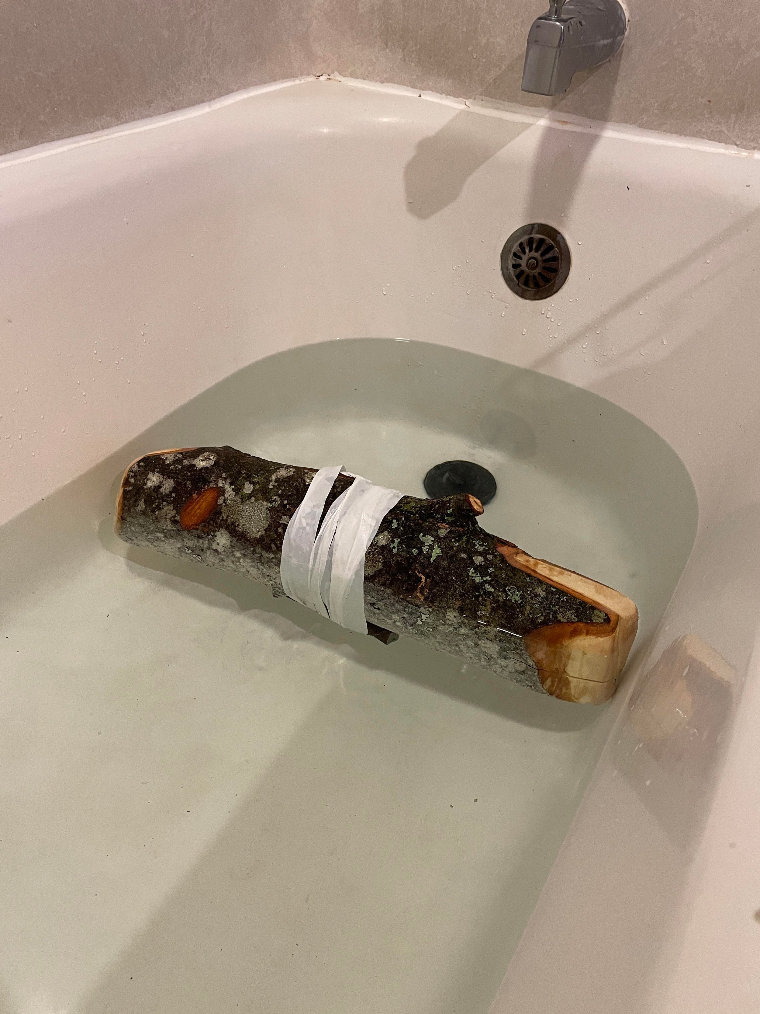

Img. 2: GPS Log buoyancy and ballast test
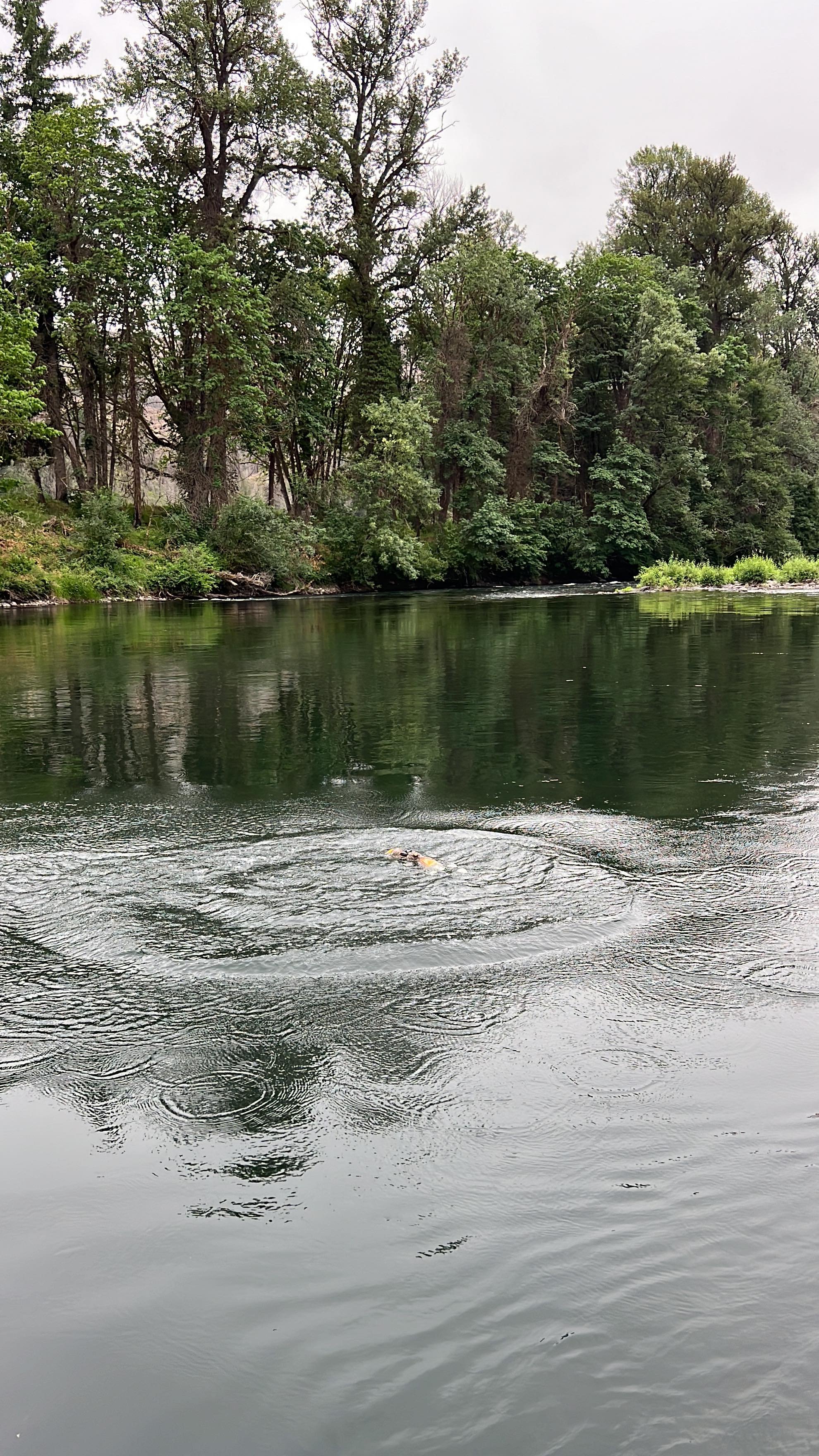
Img. 3: GPS Log swim and visibility test
Multiple controlled and field studies were done in order to engineer and train GPS Log for a successful voyage.


Img. 3: GPS Log preparing for the big day
Img. 4: GPS Log ready for deployment
Img. 5 : GPS Log deployed